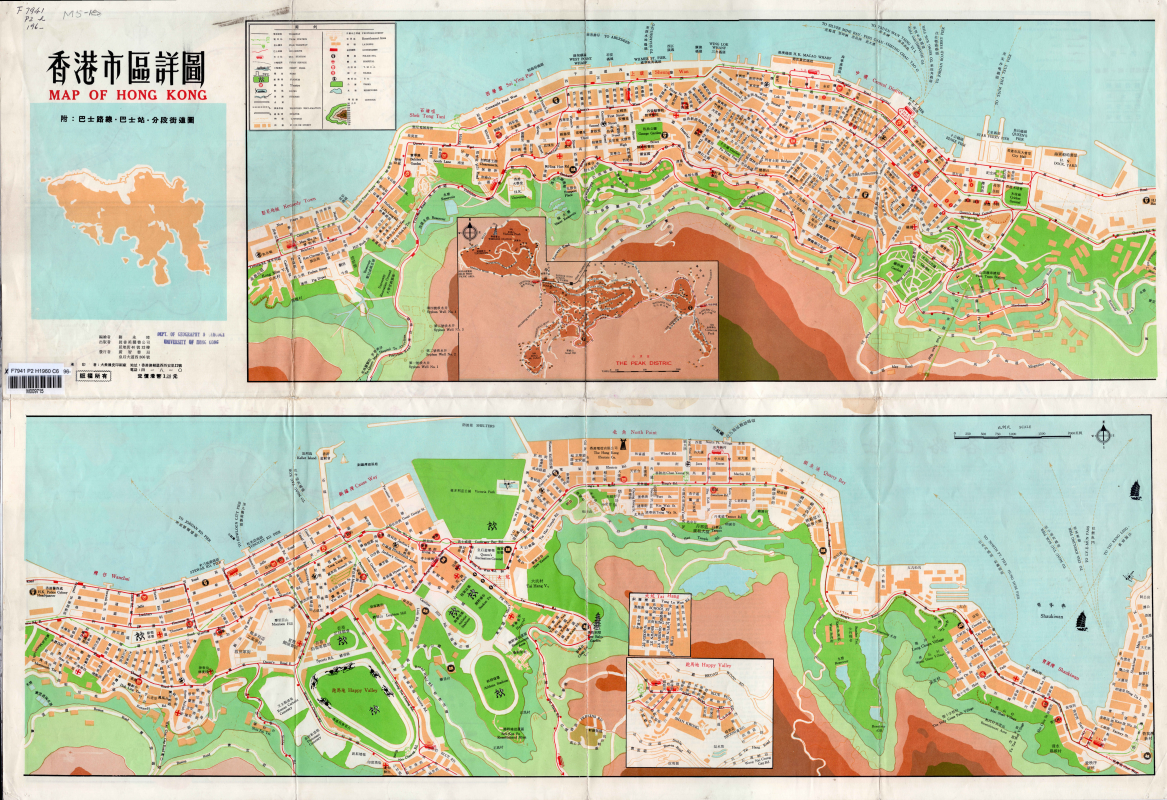
LoginMenu
ReturnResources
Map of Hong Kong = 香港市區詳圖 =Xianggang shi qu xiang tu
GMDMap
LanguageEnglish & Chinese
ClassificationF7941 P2 H1960
Publisher真善美圖書公司, Hong Kong, 1960
SubjectTransportation, Bus lines -- Hong KongMaps -- Hong KongOld Map - Hong KongMaps -- Hong Kong Island (Hong Kong)
Description1 map : col. ; 54 x 78 cm. folded to 16 x 11 cm. 6 copies.

Notes

Road maps with bus lines and bus stops.
附﹕巴士路線、巴士站、巴士分段圖
香港各路巴士經過路線街名表
香港環島巴士交通詳圖
No.
Barcode
Branch
Location
Call No.
Status
Due Date
1
M009711
Library
Library
F7941 P2 H1960 C5
Available
--
2
M009712
Library
Library
F7941 P2 H1960 C1
Available
--
3
M009713
Library
Library
F7941 P2 H1960 C4
Available
--
4
M009714
Library
Library
F7941 P2 H1960 C2
Available
--
5
M009715
Library
Library
F7941 P2 H1960 C6
Available
--
6
M009716
Library
Library
F7941 P2 H1960 C3
Available
--
Total 6 Records , Current 1 / 1 Page:PreviousNext
Related Resources