Login
Menu
Return
Resources
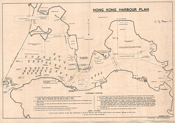
Hong Kong Harbour Plan. [1952]
GMD
Map
Language
English
Classification
F 7942 V5G45 1952
Publisher
1952
Subject
HONG KONG ISLAND
Harbors -- Hong Kong
Old Map - Hong Kong
City Planning - Hong Kong - Victoria Harbour
Description
Map: b&w.; 69 x 78 cm.
Notes
Digitized by Vinci Cheung, map intern 2020
No.
Barcode
Branch
Location
Call No.
Status
Due Date
1
VC0011
Library
Cabinet 7
F 7942 V5G45 1952
Available
--
Total 1 Records , Current 1 / 1 Page:
Previous
Next