Login
Menu
Return
Resources
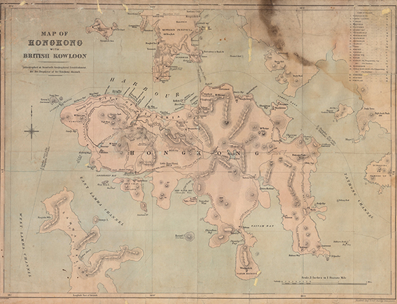
Map of Hong Kong with British Kowloon. [1888]
Stanford's Geographical Establishment
GMD
Rare map
Language
English
Classification
R7942 V5 1888
Publisher
Stanford's Geographical Establishment, London, 1888
Subject
HONG KONG ISLAND
Old Map - Hong Kong
Description
Map: b&w.; 77 x 59 cm.
Notes
Digitized by Vinci Cheung, map intern 2020
No.
Barcode
Branch
Location
Call No.
Status
Due Date
1
VC0005
Library
Map room (Antique)
R7942 V5 1888
Available
--
Total 1 Records , Current 1 / 1 Page:
Previous
Next