LoginMenu
ReturnResources
Lan-Tao Island [1962]
GMDRare map
LanguageEnglish
ClassificationF7942 L2 G51 1962
PublisherCrown Lands and Survey P.W.D. Hong Kong, hong kong
SubjectGeology - Lantau Island (Hong Kong)
Description

map col.

89 x 83 cm, was folded to 22 x 16 cm.

Notes

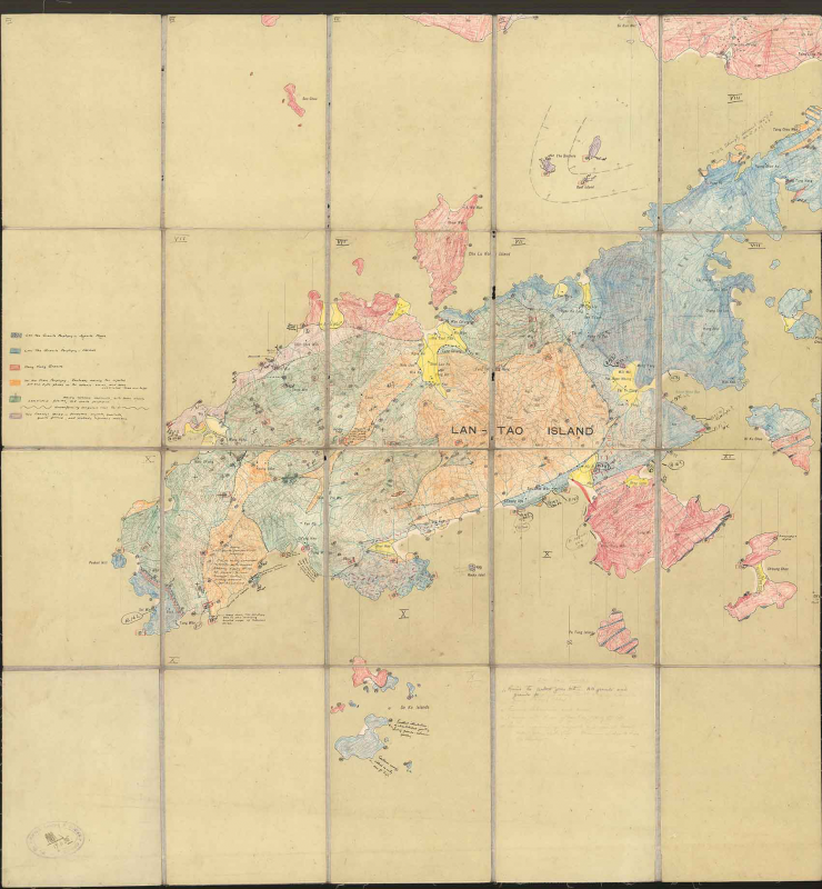
in lower left corner it have a chop from P. W. D. Crown Lands & Survey Office with a signature and date 17-11-1962, which support that it is an official record map.

it is the manuscript of Geological survey on Lantau island, sold and superficial geology. Type of rocks was colored by hand.

No.
Barcode
Branch
Location
Call No.
Status
Due Date
1
L00174
GEOG
Map room (Antique)
F7942 L2 G51 1962
Available
--
Total 1 Records , Current 1 / 1 Pageļ¼šPreviousNext